
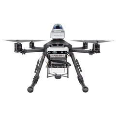
P450 Research UAV Development Platform
- $732.00
- $732.00
- 单价
- 单价
小计:
$732.00
无法加载取货服务可用情况
Shipping
Shipping options and costs are calculated at checkout or confirmed in your quotation.
Delivery time depends on destination, customs clearance, and product availability.
Returns & Refunds
Eligible returns and refunds follow our Refund Policy.
Return shipping is handled according to the policy terms.

Description
xMedia
xFlyCore video resources from the ROBOSN channel, including autonomous exploration, FUEL reproduction, ground-station development, and the FlyCore hands-on series.
Reproducing the FUEL Algorithm on a Drone with AI
Watch on YouTubeEpisode 3: I Let AI Build a Drone Ground Station - Then Tested It in Real Flight
Watch on YouTubeEpisode 2: FlyCore Makes Building an AI Drone Much Easier Than You Think
Open channel videosEpisode 1: What Is FlyCore? A New Way to Build Your Own AI Drone
Watch on YouTubeShipping & Return
xShipping
Shipping options and costs are calculated at checkout or confirmed in your quotation. Delivery time depends on destination, customs clearance, and product availability.
AMOVLAB ships technical products globally where logistics and compliance allow. Freight, duties, taxes, customs clearance, and delivery timelines may vary by destination and order configuration.
Returns & Refunds
Eligible returns and refunds follow our Refund Policy. Return shipping is not automatically free unless the return is caused by our error, a confirmed defective item, or another case covered by the policy.
Prometheus 450
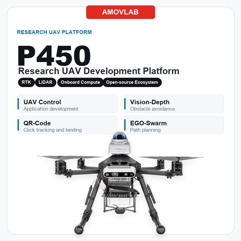
P450 research UAV development platform.
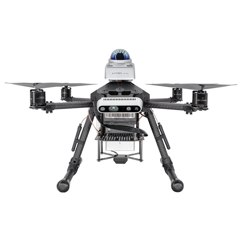
Prometheus 450, referred to as P450, is a 410 mm class research UAV based on the F410 flight platform. It supports indoor and outdoor autonomous flight development, visual obstacle avoidance, gimbal tracking, LiDAR SLAM, dynamic path planning, and Prometheus professional ground-station workflows.
P450
Research UAV Development Platform
410 mmMedium-size quadrotor research platform based on F410.
RTK + SLAMSwitch between outdoor RTK and indoor Mid-360 LiDAR positioning.
D435i / G1Two application versions for visual obstacle avoidance or gimbal tracking.
EGO-SwarmDynamic path planning and obstacle avoidance at up to 2 m/s.
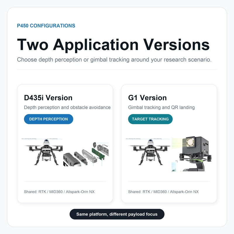
D435i visual obstacle-avoidance version
P450_RTK_Allspark2_MID360_D435i integrates the Intel RealSense D435i depth camera for visual perception, depth-based obstacle avoidance, and autonomous navigation research.

G1 gimbal tracking version
P450_RTK_Allspark2_MID360_G1 integrates the G1 optical gimbal for target recognition, target tracking, QR-code guidance, and camera/gimbal control experiments.

Function Highlights
Function highlights for autonomous UAV development.
Core capabilities are organized into structured modules, making positioning, tracking, planning, landing, and control workflows easier to evaluate.
01 / Multi-scene positioning
Indoor and outdoor workflows with positioning-source switching.
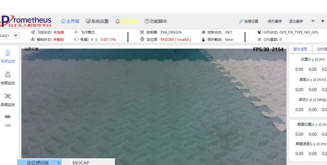
For indoor scenarios, P450 runs Mid-360 hardware with the Fast-LIO LiDAR SLAM algorithm to achieve accurate indoor positioning. For outdoor open-space scenarios, it uses RTK hardware for high-precision positioning. Prometheus GroundStation supports switching between positioning sources for different environments.
- Indoor: Mid-360 + Fast-LIO for LiDAR SLAM positioning.
- Outdoor: RTK hardware for high-precision hover and navigation.
- Ground-station workflow: visual positioning-source switching in Prometheus professional ground station.
02 / Gimbal control
Control, shoot, record, and lock targets through the G1 gimbal.
With the G1 optical gimbal, P450 can read or control gimbal status through ROS interfaces and Prometheus GroundStation. Combined with SpireCV, the onboard system can detect and track targets, lock targets in real time, and guide precise autonomous landing toward QR codes at different heights.
- Gimbal camera control, shooting, recording, and target locking.
- ROS interface access for integration into developer workflows.
- SpireCV-based detection and tracking for gimbal-guided tasks.
03 / Target click tracking
YOLOv5 detection plus Nanotrack target locking.
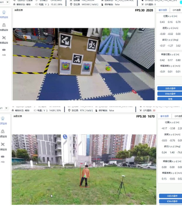
P450 can use YOLOv5 detection with a specified training dataset or the COCO general dataset. After a target is selected, the Nanotrack tracking algorithm locks and tracks it. Indoor tests can use a gimbal-following trained cart target, while outdoor tests can use general-person recognition for tracking.
- YOLOv5 detection with custom training data or COCO general data.
- Nanotrack target locking after click selection.
- Prometheus GroundStation supports dynamic target-distance tracking mode switching.
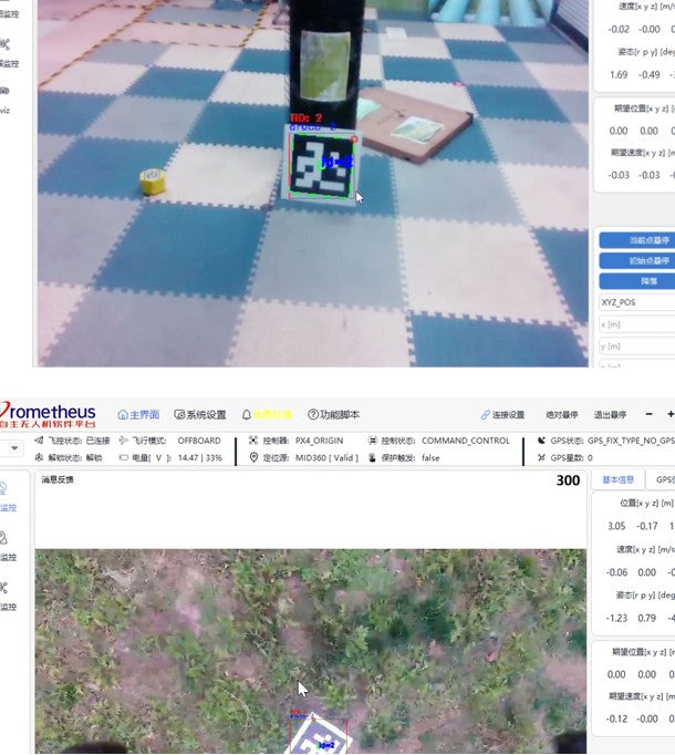
04 / QR-code tracking and landing
Detect, estimate, track, and guide landing toward QR codes.
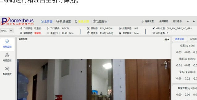
Using the SpireCV vision library, P450 can precisely detect QR codes and estimate their position. It supports QR-code click tracking, and when tracking is canceled, the UAV hovers. For landing, the G1 can guide the UAV toward a QR code at different heights, keeping the optical gimbal camera center and QR-code center within a 30 cm error range.
- QR-code precise detection and position estimation.
- Click tracking with hover behavior after cancellation.
- Outdoor 2 m gimbal-height QR-code guided landing workflow.
05 / EGO-Swarm
Dynamic path planning for complex operating scenes.
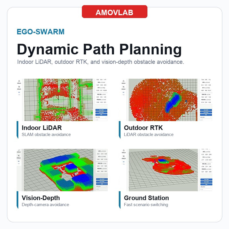
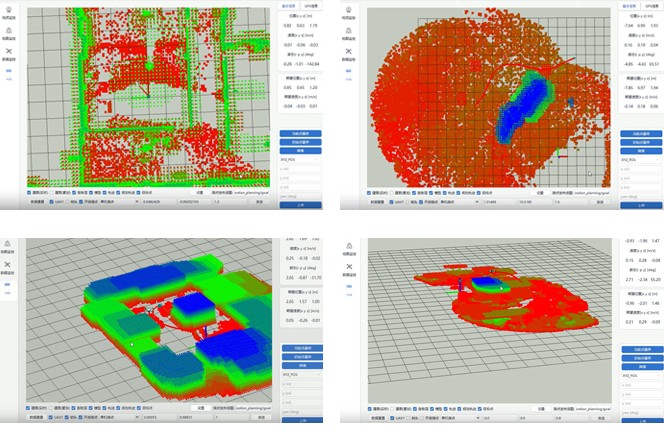
P450 supports EGO-Swarm, an upgraded EGO-Planner path-planning algorithm. It improves the UAV's autonomy in dynamic environments by analyzing and avoiding moving obstacles in real time, adapting quickly to dynamically adjusted target points, and supporting efficient task execution in unknown and complex scenes.
- Indoor LiDAR positioning with LiDAR obstacle avoidance.
- Outdoor RTK positioning with LiDAR obstacle avoidance.
- Visual-depth obstacle avoidance in indoor and outdoor workflows.
- Simple setup with Prometheus GroundStation; obstacle-avoidance flight up to 2 m/s.
06 / Reliable control module
Seven control sub-modes for development and flight testing.
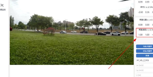
P450 integrates single-antenna high-precision RTK hardware for accurate outdoor hover. The Prometheus control sub-module acts as the bridge between software and aircraft, supporting initial-position hover, current-position hover, landing, and movement control states.
- Six control sub-modes covering inertial-frame and body-frame position, velocity, and position-velocity composite control.
- Trajectory control mode, for a total of seven sub-modes.
- GroundStation command interface for fast switching and verification.
Hardware Highlights
Modular aircraft, compute, positioning, perception, and gimbal payloads.
Aircraft, compute, positioning, perception, and payload hardware are grouped so engineering details remain visible during evaluation and configuration.
Modular airframe design
Flexible payload mounting, composite-material body to reduce weight and extend flight time, semi-enclosed fuselage for stronger protection, optimized wiring, and replaceable vulnerable body parts to reduce repair cost.
Allspark-Orin NX onboard computer
Allspark micro edge computer with NVIDIA Orin NX module, 100 TOPS floating-point capability, compact size, low weight, strong migration capability, GPU acceleration, and pre-installed development environment.
Mid-360 3D LiDAR
Safe and reliable LiDAR distance sensor for mapping, localization, recognition, obstacle avoidance, and SLAM. It features 360 x 59 degree FOV, 200,000 points/s, 0.1 m near blind zone, 65 x 65 x 60 mm size, and 265 g weight.
F9P centimeter-level positioning
P450 uses an F9P positioning module outdoors. With the ground-base module and P450 LQ link, RTCM data is transmitted to the aircraft-side F9P in real time for centimeter-level positioning.
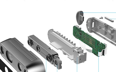
Intel RealSense D435i depth camera
D435i integrates the Intel RealSense D4 vision processor, depth sensing, and IMU. It provides real-time depth calculation and 3D visual perception for indoor and outdoor illuminated scenes.
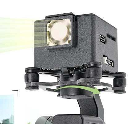
G1 optical gimbal
Three-axis anti-shake gimbal with OV OS12D40 color image sensor, CMOS 1/2.49-inch sensor, up to 60 fps at 11.3 MP, 4512 x 2512 image signal, 1.404 um pixel size, and up to 4K@30 fps video recording.
 Modular design, 410 mm wheelbase, and Allspark onboard computer.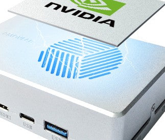
Software Highlights
Prometheus V2, SpireCV, and PrometheusGroundStation.
The P450 is not only an airframe. It is shipped as a research platform around the Prometheus autonomous UAV software ecosystem.
After years of development, Prometheus forms an ecosystem from simulation to real flight. It is based on PX4 open-source flight-control firmware and ROS1 / ROS2, and integrates control, planning, swarm, LiDAR SLAM, and SpireCV modules.
SpireCV is an edge real-time perception SDK for intelligent unmanned systems. SpireCV 2.0 supports node-based programming, SpireMS messaging, camera/gimbal control, video saving and streaming, stream reading, target detection, recognition, and tracking.
The Qt-based ground station uses TCP / UDP communication and avoids complicated multi-vehicle communication configuration. It provides real-time UAV state monitoring and one-click takeoff, landing, and position-control commands.
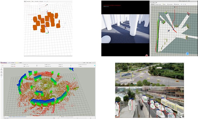
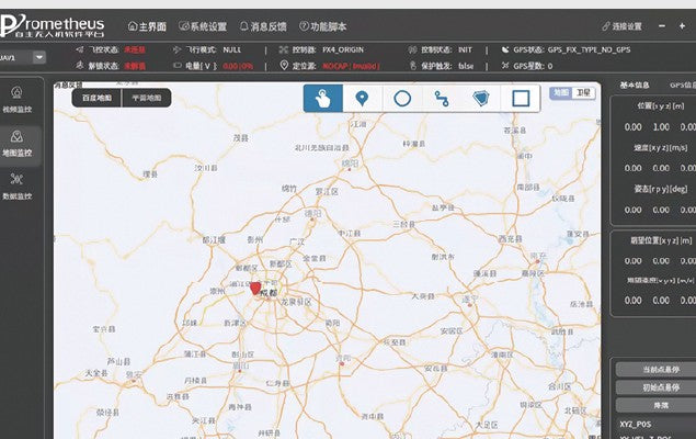
Use Windows / Ubuntu simulation engines, ground-station interaction, visual perception modules, and onboard real-flight verification to move from algorithm development to actual UAV behavior.
Specifications
Readable specifications for engineering comparison.
Grouped specification tables let engineering buyers compare aircraft, compute, sensors, communication, and software environment details directly.
Aircraft
| Aircraft type | Quadrotor |
|---|---|
| Takeoff weight | Approx. 2.220 kg, including battery and payload |
| Diagonal wheelbase | 410 mm |
| Dimensions | 290 x 290 x 280 mm |
| Maximum takeoff weight | 2.2 kg |
| Hover endurance | 10 min 29 s |
| Hover accuracy | RTK: vertical +/-0.1 m, horizontal +/-0.15 m; Mid-360: vertical +/-0.1 m, horizontal +/-0.1 m |
| Operating temperature | 6 deg C to 40 deg C |
Allspark-Orin NX onboard computer
| Name | Allspark-Orin NX onboard computer |
|---|---|
| Model | IA160_V1 |
| Weight | Approx. 188 g |
| Dimensions | 102.5 x 62.5 x 31 mm, including fan |
| Processor | NVIDIA Jetson Orin NX |
| Memory | 8 GB LPDDR5 |
| Compute | 70 TOPS |
| GPU | 1024-core NVIDIA Ampere GPU with 32 Tensor Cores |
| CPU | 8-core Arm Cortex-A78AE v8.2 64-bit CPU, 2 MB L2 + 4 MB L3 |
| SSD | 128 GB, built-in M.2 interface, expandable |
| Ethernet / WiFi | 100 Mbps x2, one independent port and one switch port; 2.4G WiFi |
Power, link, remote controller, charger
| Battery | 130 x 65 x 40 mm, 470 g, 16.8 V charge-limit voltage, 14.8 V nominal voltage, 5000 mAh capacity |
|---|---|
| Data link | LQ-3, 2.4 GHz, 18 dBm transmit power, 40 Mbps max bandwidth, 12 V operating voltage, 1 km transmission distance |
| Remote controller | AMOVLAB QE-2, 4.5 V-9 V, 8 channels, <20 dBm transmit power, 497 g, 179 x 81 x 161 mm |
| Charger | C1-XR, 100 V-240 V AC input, 11 V-18 V DC input, 130 x 115 x 61 mm, 380 g, 0.1 A-10 A charge current, 1-6 cells |
D435i and optical-flow ranging module
| D435i model | Intel RealSense D435i |
|---|---|
| D435i size / weight | 90 x 25 x 25 mm; 72 g |
| Depth technology | Active stereo IR; global shutter depth sensor |
| Depth FOV | 86 x 57 degrees, +/-3 degrees |
| Depth resolution / FPS | 1280 x 1080, 30 FPS max |
| RGB sensor FOV | 69 x 42 degrees, +/-1 degree |
| Depth range | Minimum 0.105 m, maximum approx. 10 m |
| Optical-flow module | 4.5 g, 29 x 16.5 x 15 mm, 0.01-3 m ranging range, 6 degree ranging FOV, 42 degree optical-flow FOV, 500 mW, 4.0-5.5 V, >80 mm working distance, UART output |
Livox MID360 LiDAR
| Model | Livox MID360 |
|---|---|
| Laser wavelength | 905 nm |
| Range | 40 m at 10% reflectivity |
| FOV | Horizontal 360 degrees, vertical -7 to 52 degrees |
| Near blind zone | 0.1 m |
| Point cloud frame rate | 10 Hz typical |
| Point output | 200,000 points/s |
| Data interface | 100 BASE-TX Ethernet |
| Sync | IEEE 1588-2008 PTP v2, GPS |
| IMU / voltage / size / weight | ICM40609; 7-27 V; 65 x 65 x 60 mm; 265 g |
| Operating temperature | -20 deg C to 55 deg C |
G1 optical gimbal
| Model | G1 |
|---|---|
| Size / weight | 56.02 x 51 x 79.41 mm; 104 g |
| Input voltage | 3S-4S |
| Stream / encoding | RTSP common; H.264 |
| Resolution | 4K30fps, 2.7K30fps, 1080P@30fps, 720P@30fps |
| Aperture / FOV | F/NO. 2.0; diagonal 143 degrees, vertical 69 degrees, horizontal 125 degrees |
| Optical zoom | Not supported |
| Sensor | CMOS, OV OS12D40, 11.3M effective pixels, 1/2.49-inch, 1.4 x 1.4 um pixel size |
RTK base station and rover
| Base station chip | ZED-F9P |
|---|---|
| Rover chip | B9 RTK GNSS module |
| Frequency | GPS L1/L2, GLONASS G1/G2, BDS B1/B2, GALILEO E1/E5b, QZSS L1/L2 |
| Working mode | GPS + GLONASS + BDS + GALILEO + QZSS combined positioning |
| Base size / weight | Diameter 160 mm, height 66.5 mm; <=600 g |
| Rover size / weight | Diameter 46.76 mm, height 34.2 mm; 20 g |
| Connector | Base: GX12-4 aviation plug; rover: GH1.25 8Pin |
| Update rate / baud rate | 0.25-20 Hz, default 1 Hz; default 38400 bps |
| RTK accuracy | Horizontal 0.01 m + 1 ppm CEP; vertical 0.01 m + 1 ppm CEP |
Software environment
| Onboard computer model | Jetson Orin NX |
|---|---|
| System | Ubuntu 20.04 |
| User / password | amov / amov |
| L4T / JetPack | L4T 35.6.0; JetPack 5.1.4 |
| CUDA | 11.4.315 |
| RealSense SDK / ROS | RealSense SDK 2.50.0; RealSense ROS 2.3.2 |
| ROS / OpenCV | ROS noetic; OpenCV 4.7.0 |
Packing List
Two versions, clearly separated.
The comparison table separates the two configurations clearly. The only difference between the versions is the D435i depth camera versus the G1 gimbal payload; the remaining development platform accessories are included in both configurations.
| Equipment | D435i visual obstacle-avoidance version | G1 gimbal tracking version |
|---|---|---|
| F410 frame x1 | Included | Included |
| Pixhawk 6C flight controller x1 | Included | Included |
| F9P RTK positioning module x1 | Included | Included |
| 2216-960KV motor x4, 30A 4-in-1 ESC x1, 1045 propeller x4 | Included | Included |
| FB45 power battery x1 and C1-XR smart charger x1 | Included | Included |
| LQ-3 data link x1 set | Included | Included |
| Intel RealSense D435i depth camera x1 | Included | Not included |
| G1 gimbal x1 | Not included | Included |
| Livox MID360 LiDAR x1 and custom LiDAR mounting structure x1 set | Included | Included |
| Micro HDMI capture self-developed computer accessory x1 | Included | Included |
| Allspark2 Orin NX 8GB onboard computer x1 | Included | Included |
| AMOVLAB QE-2 remote controller x1 | Included | Included |
| 12V power adapter / separate onboard-computer 12V supply x1 | Included | Included |
| RTK ground base station x1 | Included | Included |
| Leveling tripod 1.3 m x1, 1.5 m Ethernet cable x1, Type-A/C data cable x1, screw tool kit x1, safety rope x1, QR landing board x1, spare cables x1 pack, beeper x1 | Included | Included |
Configure P450 around your research scenario.
Choose the D435i version for depth-perception and obstacle-avoidance research, or the G1 version for gimbal tracking, QR-code guidance, and visual target workflows. AMOVLAB can help align the positioning, payload, compute, and software stack with your lab or developer-training plan.
Related Products
- 选择某一选项会使整个页面刷新。


